QFabric: A Multi-Task Change Detection Dataset
Advancing AI for Urban and Environmental Change Analysis
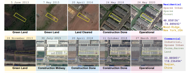
QFabric is a multi‑task geospatial dataset designed for change detection in urban and environmental settings. It curates high‑resolution satellite imagery to support segmentation, classification, and object detection tasks, enabling accurate tracking of land cover changes.
Published in CVPR 2021, QFabric standardizes evaluation protocols and fosters reproducible deep learning experimentation. It bridges the gap between research and real‑world applications, advancing automated environmental monitoring and urban planning.
- Curates high-resolution satellite images for multi-task change detection.
- Supports tasks like segmentation, classification, and object detection.
- Aims to standardize change detection benchmarks in geospatial AI.
Change Detection
Geospatial AI
Computer Vision